1/ Coldharbour Farm – Scotland Farm – 2 miles of the Madingley Road – Magdalene Bridge – Butts Green – footpath across Coldham’s Common – Six Mile Bottom crossroads.
2/ Fenstanton church – 4½ miles of the Huntingdon Road – ancient cemetery at Girton – Cambridge Castle Mound.
3/ Longstanton Church – 1 mile straight road – east vallum of camp – St. Clement’s – Round Church – Petty Cury crossroads – Hills Road.
4/ Belsar’s Hill camp – Woodhouse Farm – Mount Pleasant (Roman rampart) – Mill Pit and footpath – Great Shelford church – Strethall church.
5/ Roman camp south of Ely – 2 miles of Akeman Street – Mount Pleasant – Barrington ch.
6/ Milton moat – Chesterton moat – Petty Cury xrds – Mill Pit (2 boundary stones) – Haslingfield ch – tumulus beyond Morden Grange.
7/ ½ mi road at Horningsea – Horningsea ch – Midsummer Common – St Clement’s (orientated) – Barton moat and ch – Thorn Hill.
8/ Whaddon ch – Hoback Farm – Harston road junction – camp at Shelford – Fulbourn ch – Great Wilbraham ch – ch in Newmarket. {88}
9/ Moat near Guilden Morden – Wendy moat – Wimpole circular pond – Orwell ch – Harlton ch – part of Newmarket Road – Barnwell St. Andrew’s – Fen Ditton ch.
10/ Ancient ch at Malton Farm – Little Shelford ch – Great Shelford ch – centre of Wandlebury – Six Mile Bottom crossroads – Cheveley Castle.
11/ Tadlow moat – Fox Hill – Trumpington church – Cherry Hinton church – Beacon farm –2 miles of the Icknield Way.
12/ Great Eversden ch – Little Eversden ch – north vallum of Shelford Camp – Copley Hill tumulus – The Tower – road at Weston Colville – xrds and ch at Carlton.
13/ Little Gransden ch – Kingston ch – Comberton ch – Barton ch – Fulbourn ch – Fulbourn moat.
14/ Caxton Gibbet xrds – Hardwick moat – Great St. Mary’s – Market Hill – Petty Cury xrds – Teversham ch – Little Wilbraham churchyard – centre of circular enclosure at Allington Hill – fiveways crossroads at Stetchworth – Stetchworth rd jncn.
15/ Rd jncn at Papworth – Boxworth ch – Noon Folly Farm – Oakington ch – Landbeach moat – Waterbeach xrds.
16/ 4 miles of Ermine Street – Caxton Gibbet – Kingston moat – Melbourn Bury – Munsey Farm – Barley church.
17/ Conington ch – moat at Lolworth – (possible alignment of trees at Bar Hill, now cut down – N.P.) – Girton ch – Arbury camp – 2¼ miles of the F1eam Dike – Six Mile Bottom xrds – The Chantry.
18/ Noon Folly Farm – Goffer’s Knoll – Noon’s Folly Farm nr. Royston – high point nr. Barley.
19/ Exning ch – the Abbey, Swaffham Prior – Anglesea Abbey – mile of Chesterton Road –Cambridge Castle mound.
20/ West Wickham moat – Mark’s Grave (also known as The Middle of the World – N.P.) – ½ mile field path – Linton ch – Chrishall Down – Barley Hill.
21/ Sturmer ch – moat at Horsham Hall – Ashdon Hill – Elmdon ch – Chrishall xrds – Great Chishill ch.
22/ Stream crossing at Steeple Bumpstead – Helions moat – Goldstones – Heavy Hill – Burloes – tumuli – the Bury, Ashwell.
23/ Shudy Camps ch – Hildersham ch – ½ mile of field road – Trumpington ch – Grantchester ch.
24/ Latchley’s Farm moat – Helions moat – Castle Camps moat – Castle Camps ch – Bartlow ch – Linton ch.
25/ Helions moat – Carlton Green road jncn – Carlton xrds and ch – moat below Burrough Green – moat – 1/3 mile village road at Stetchworth.
26/ Pen Hills – south end & ¼ mile road at Bassingbourn – Kingston Wood moat– Bourn rd jncn – tumulus north of Bourn.
27/ Cold Harbour – Hatley Gate – 1¼ mile track – Little Gransden ch – Great Gransden ch – moat below Eltisley – Papworth St Agnes ch.
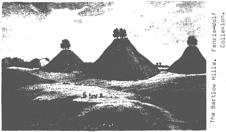
28/ North edge of Arbury Camp – tumulus near Morden Grange – 2 tumuli – Royston ch – 2 miles of the Icknield Way – Noon’s Folly Farm – Bartlow Hills.
{89}
29/ Melbourn tumulus – Little Trees Hill – centre of Wandlebury – Fulbourn moat – Great Wilbraham ch.
30/ Hatley Gate – Hoback Farm – Newton ch – dogsleg in road at Newton – ¼ mile of road at Sawston – Sawston ch – Little Abingdon ch – West Wickham ch.
31/ Bridge crossing River Cam – Northend place and piece of road – 326′ hill point – crossroads near Pampisford Station (nodal point) – North Hills.
32/ Mortimers – Ashdon ch – centre of Allington Hill – tumulus – gap in the Devil’s Dike – road jncn nr Burwell.
33/ Ashwell ch – 1 mile of Ashwell St. – 1 mile of field track – the Spike rd jncn.
34/ North edge of Arbury Banks – 1¼ miles of Ashwell Street – Newton ch.
35/ Site of cemetery south of Littleton – 2 miles of Ashwell Street – Fowlmere ch – ¾ mile field road past Thriplow – Spike rd jncn.
36/ Boxworth ch – ½ mile straight road at Dry Drayton – Wrangling Corner – 1½ miles of Via Devana.
37/ 2 miles of Icknield Way through Thetford Road jncn – Beacon Farm – Cherry Hinton ch – Trumpington ch – Tadlow moat.
38/ 2 miles of Icknield Way – field road – rd jncn – road through Whittlesford – Thriplow tumulus – Goffer’s Knoll.
39/ 3 miles of Icknield Way – Fleam Dike at the Bedford Gap – Elmdonbury – Chrishall ch
40/ 2 miles of the Icknield Way – Duxford rd jncn – circular enclosure on hill point – Chishill Down.
41/ West Wratting ch – 1 mile of road nr Pampisford – Pampisford ch – Thriplow rd jncn – Melbourn tumulus – Limlow hill tumulus.
42/ 4 miles straight section of Ermine Street – Caxton Gibbet – Kingston Wood moat – Melbourn Bury – ½ mile road – Barley ch.
43/ Road jncn east of Papworth St. Agnes – moat east of Papworth Everard – 13½ miles of Ermine Street from Caxton Gibbet through Royston.
44/ Road jncn near Pampisford Station (now closed – N.P.) – 2¼ miles of straight road –Heath Farm moat – Pen Hills.
45/ Road jncn near Pampisford Station – Duxford ch – 2 miles of straight road.
46/ West Wickham moat – Mark’s Grave xrds – Linton ch – 1½ miles of straight road – Chishill Down.
47/ Exnal ch – Burwell ch.
48/ Henny Hill – Soldiers’ Hill edge – Impington ch – Coton ch.
49/ Caxton ch – zigzag in road – Toft ch – Caldecote ch – Croxton ch – Hail Weston – Yeldon ch – Yeldon castle hill.
50/ Great Avenue of Wimpole (now cut down, as it was an Elm avenue which suffered in the epiphytotic of Dutch Elm Disease – N.P.)
51/ Hill point – Heydon ch – section of road – boundary, track and tumulus of Valance Farm – Great Chesterford ch – xrds – Hadstock ch.
52/ Soham causeway – Ely Cathedral – Fordham Abbey.
53/ Moat at Manor Farm, Great Eversden – Grange Farm – St. Peter’s Cambridge – Chesterton moat – Biggin Abbey.
54/ Moat near Hatley – tower at Wimpole Avenue – Hauxton road jncn – Great Shelford ch – Stapleford road jncn – straight road and field track for 1¼ miles.
55/ Papworth Hall moat – Knapwell ch – Eye Hall – Swaffham Prior ch (ley parallel to No. 15).
56/ Papworth St. Agnes ch – Caxton Pastures moat – Hoback Farm – Melbourn tumulus – Heath Farm moat – Barley ch.
57/ Arbury Camp – Donkey’s Common (now Parkside Swimming Pool – N.P.) – road jncn at Sawston – Spike rd jncn – 3 mile straight road – Great Chesterford ch – Littlebury.
58/ South edge of Arbury Banks – Gofrer’s Knoll – Road jncn at ‘Coach and Horses’ – Hinxton xrds – Linton moat – West Wickham ch – 397′ high point.
59/ Royston crossroads – ¾ miles of Icknield Way – Noon’s Folly Farm – xrds – 1 mile of track – Ickleton ch – Haws Hill 272′ high point.
60/ Wiggens Green – Wigmore Pond – Goldstones – Byrds homestead – rd jncn – Littlebury ch – xrds near Catmere End.
61/ Tumulus north of Stunner Hall – Wiggens Green – Helions Bumpstead church – Helions moat – road jncn – section of road.