Ancient Mysteries no. 17, October 1980 (continuation of Journal of Geomancy)
See the explanation beneath the map. Lambarde’s text describing the beacons was published in Ancient Mysteries no. 18.
{32 & 33}
{34}
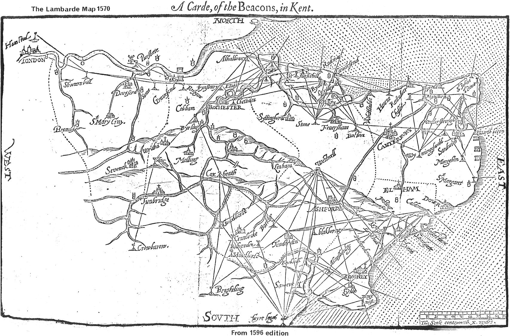
The map overleaf is taken from William Lambarde’s The Perambulation of Kent, published originally in
1570. This map is from the 1596 edition in the Cambridge University Library. It shows the beacon system of Kent and its
alignments – the first map to do so. Its publication led to Lambarde being accused of aiding the enemy
(ie. Spain), but he explained that it was actually an aid to the crews manning the beacons, as it showed the
direction of the other beacons from each beacon.
It is also of great interest because it demonstrates a knowledge of alignments 410 years ago, an era when the suppression of the monasteries was still within living memory.