The Ley Hunter No. 70 (1976), 10–13
Reprinted, with changes, in Undercurrents No. 17 (August–September 1976), 14–17
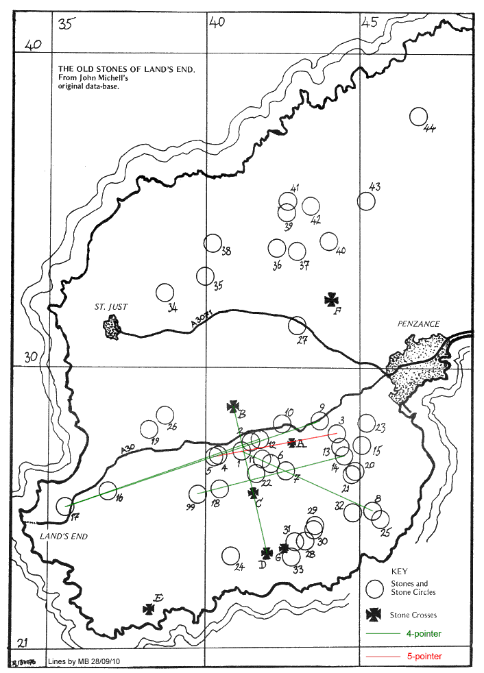
This is a study of the megalithic alignments described by John Michell in his book The Old Stones of Land’s End (1974). It is perhaps the first study to apply computer simulations to a set of actual sites.
Yellow highlighting marks text that appeared only in The Ley Hunter; blue, only in Undercurrents. The map of West Penwith appeared only in Undercurrents.
Chris Squire has already placed the text of Undercurrents 17, but without the artwork, on the Web. He writes: “There are no restrictions on the use of this material but please credit individual authors where credit is due: they are mostly still with us.”
The digitized version contains the following Web pages:
| TEXT |
|---|
| Main text |
| IMAGES |
|---|
| Map of West Penwith, showing megalithic sites |
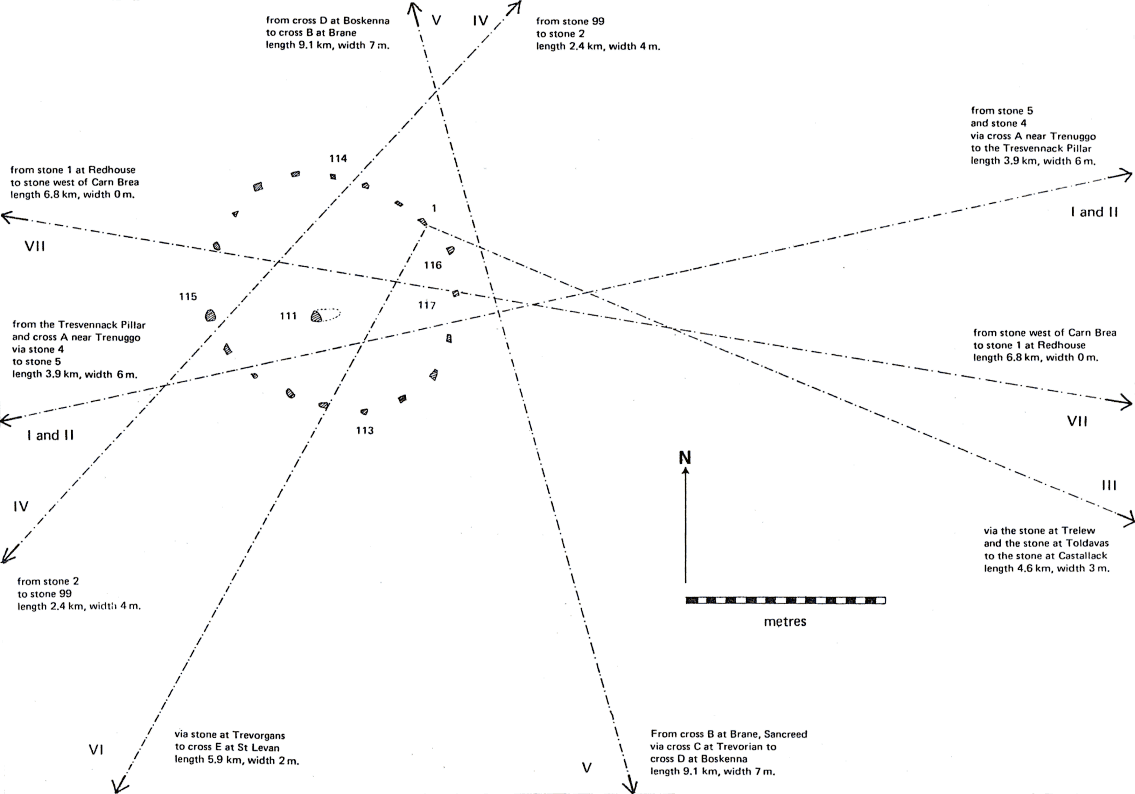
| Plan of Boscawen-un stone circle, with alignments |
| EXTRA |
|---|
| Comments by Bob Forrest (© 1979) |
| List of grid references |