Journal of the Derbyshire Archæological and Natural History Society, 29, 103–112 (1907) and 33, 87–94 (1911).
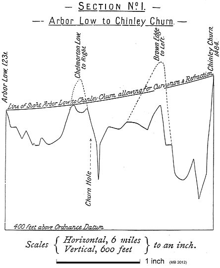
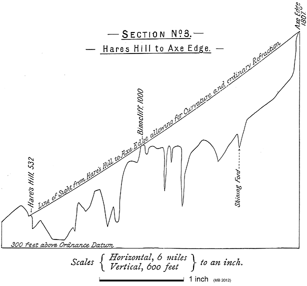
These articles are another example of pre-Watkins landscape geometry. The sites considered are mostly in Derbyshire. In the first article, Matthews describes lines running due south and 30° east or west of north. In the second, he considers points that align not merely on the map, i.e. in 2 dimensions, but in 3-dimensional space. He also extends the set of angles to include the whole clock face.
Thomas Arthur Matthews (1850–1914) is listed in the 1911 census at Ashbourne, Derbyshire, as a retired civil engineer and public works contractor.
The second of these articles was republished in The Ley Hunter, no. 83 (1978), pp. 3–5.
The digitized version contains the following Web pages:
| TEXT |
|---|
| Some notes on Arbor Low and other lows in the High Peak (1907) |
| Some further notes on the lows in the High Peak (1911) |
![Sketch of south end of Stone No. 1 [Arbor Low]](../images/stone.png)
![[Divisions of the circle]](../images/circle_div.png)