{167}

LOCAL MARKSTONES, ROADS AND TRACKWAYS.

BY R. C. DUNT.

(Assistant Secretary Beccles and District Historical Society.)

Some Markstones and Trackways of Beccles and District, Suffolk.

IN view of the fact that the object of the Society represented by this Journal is “to popularise Antiquities of every Description” this article is submitted in the hope that it will elicit further elucidation of the above subject on which an able and interesting paper was read recently to the Beccles Historical Society (under the inspiring chairmanship of Lieut.-Col. B. Granville Baker) by the Secretary, Mr. W. Fowler. Mr. Fowler, through direct observations on local expeditions, associated with his reading of W. A. Dutt’s “Mark Stones of East Anglia” and A. Watkins’ “The Old Straight Track,” has developed a somewhat infectious enthusiasm for a study which has both enlightened and mystified him and his Society. The foregoing statement, one feels, should tend to secure the co-operation of the Journal, for while one may even encourage the creation of mists by an author, the painting of mists by an artist, one would be glad to help to dispel them through an authoritative mist-dispelling medium.

It was before the local Historical Society evolved itself from a nucleus of re-awakened interest in local history that the puzzle began in an investigation of an embedded boulder in the slope of “The Cliff” above which stands the Parish Church with its detached tower so placed on the south-east of the Church on the ancient and modern principle of “Safety First.”

Generations of increasingly civilized boys and girls have encircled this stone, sat on it, jumped off it, chipped at it, but failed to dislodge it or even to remove from the keenly imaginative vision of—to older and wiser men—upstart investigators, the glacial markings of an ice age; nor have they (the boys and girls) concerned themselves much with such questions as these: Is it a relic of pagan rites, an isolated remnant of an old watch-tower, a rough block of building stone brought down by river barges long ago {168} and was it placed there or elsewhere as a “Mark Stone” of an “Old Track”(?) Mr. Fowler says, “There is no doubt, whatever, in my mind that this stone marked the way from time immemorial.” Whether or no, it has inspired a “Sermon in Stones” and started fruitful inquiry. Our Secretary seeks Stockton Stone, Bungay Churchyard, “Druid Stone,” Harleston Stone, and notes Bixley, Bramerton, Surlingham, Hardley, Carlton, Thwaite, Bramford and Gorleston Stones and, nearer home, traces Barsham Stone and Redisham Stone to a private garden in Beccles.

Barsham Stone
Barsham Stone
No authoritative statement appears to be handed down the ages regarding “these stones” (Joshua iv. 21) but the following quotations included in our Secretary’s paper are illuminating even if they are not quite applicable. From Suckling’s Suffolk, re Gorleston:
“Many large stones arranged in the form of a circle which were removed from a field called Stone Close in the year 1768, and three from neighbouring enclosures, of a large size, and full ten feet high, attest in a great measure the truth of a tradition that Gorleston was a spot selected by the Druids for the celebration of their mystic rites.”

Pope Gregory, in writing to the Abbot Melitus in A.D. 601, commands him to tell St. Augustine not to destroy but to convert well-built temples from the worship of devils to the worship of the true God. But fifty-six years later the Council of Tours ordered priests to refuse admission to the Church of “all worshippers of upright stones,” and, a year later, the Council of Nantes exhorted them to “dig up and hide those stones which were worshipped,” while, nearly four hundred years later, Canute found it necessary to forbid the barbarous worship of stones, etc.

But whether the “Beccles Stone” and the “Stockton Stone,” its near neighbour, are among those which escaped being dug up and hidden, as an occasional font escaped the much maligned Dowsing in our churches in Cromwellian visitations, or whether they are stray stones brought down by glacier, or later on by river barge and placed, or not, in some sense as “Mark Stones” is perhaps not so much the question of our paper as their relationship to one another and to local trackways, mounds, moats and barrows {169} and whether or not it is possible to discover the key to that relationship, assuming that there is a system, by examining facts and making deductions on the lines suggested by Mr A. Watkins and by our neighbour, Mr. W. A. Dutt.

On the principle that new discoveries involve revised interpretation—in this case of place-names—our Secretary is tempted to suggest that Beccles originates from Bec=a beacon, and leys=a sighting line, rather than from leys (lays)=meadows, as suggested by another, or from Beata Ecclesia, the long accepted explanation.

This new interpretation coincides with his opinion that Beccles with its beacon tower was a central sighting point of crossing trackways. Mr. Fowler adds the comment: “Beccles was almost an island a thousand years ago and it was only connected at the southern part of the town with the mainland. With a sea of water practically on three sides of it the light from a beacon on the Cliff would be seen for a distance of at least ten miles.”

(Following a newspaper report a learned and witty speaker at the local Mayoral Banquet remarked on the gross plagiarism of the saying “All roads lead to London,” when really “All roads lead to Beccles”—a humorous ‘summing up’ which might have been lost to the merriment of the occasion had the learned Judge been in possession of all the evidence. ‘A little knowledge’ may be “a dangerous thing” but it may be also the basis of humorous touches in an after dinner speech.)

Probably Mr. A. Watkins would see in the word “lead” the permeation of the word “ley” and our local diagrams seem to confirm his conclusions as to the relationship between “Early British leys and sites, trackways, mounds, moats and camps.”

The following quotation relating to local aspects of the subject may be quoted from our Secretary’s paper:

“I am of opinion that Beccles was a crossing point of several track-ways. Investigations lead me to think that one long lay or track crossed from the south-east to north-east, passing from the heathlands of Southwold, a large part of which are now in the sea, and led through Frostenden, Sotterley, Willingham, Ellough, Beccles, Stockton, Loddon, Langley, Claxton, and Surlingham, across the river to Postwick in the direction of Kelling Heath, or diverging through Bixley to Norwich. {170} If you draw a straight line on an ordnance map through these places you will find that they pass over the sites of the cross roads or churches of the places mentioned.”

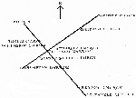
Typical alignments
Alignments
Mr. Fowler notes that Mr. Dutt in his little book on Markstones says that two of the best known stones at Stockton and Harleston appear to provide evidence of the alignment theory. A straight line drawn from the Harleston Stone to the Stockton Stone on the inch-to-the-mile map is found to pass directly through a remarkable moated pond at Earsham called the Lay Lake, five acres in extent, onwards to an earthwork tumulus on Broome Heath, over Longford Bridge, across a small tributary of the Waveney between Broome and Ellingham and after passing over the site of Stockton Stone, continues straight on to the artificial mount known as “Bell Hill” and beyond it to the elevated site of Belton Church. It will be agreed, Mr. Dutt says, that in a district where markstones are few and far between, it can hardly be by accident that the two most noteworthy of them—both of acknowledged antiquity—should align with three of the very ancient earthworks of the neighbourhood, etc.

Mr. Dutt says it can hardly be by accident; Mr. Watkins has developed upon established facts a system; Mr. Fowler seeks the key to some such system in the local instances.

The antiquaries’ interest may suggest that the subject is of more urgent importance in view of possible armies of men set to work on our highways and byways to transform them, or of sky pilots educating the mind of the travelling public to look down upon them with the same sort of indifference accorded to the canal markings of Mars.

Mr. Watkins remarks in relation to his facts and conclusions on this subject in his Foreword to the Average Reader (p. 7, “Early British Trackways”). “The antiquarians had not helped you or me very much, but had left us with vague ideas and many notes of interrogation.”

Will they help us now through the new Journal of “The Antiquarian Association of the British Isles?”