British Geomantic Pioneers 1570–1932, ed. Nigel Pennick

Institute of Geomantic Research, Bar Hill, Cambridge, 1982

From the Introduction: “Between 1976 and 1981, the IGR republished in small editions the following papers, which are gathered together for the first time here. … It is hoped that this collection will act as a stimulus to those working in the field of earth mysteries.”

The 1982 edition was duplicated from typewritten stencils, and of necessity some of the papers were abridged. For this Web version, the papers have been scanned in from the original editions and (except for Fraser’s) are republished in full.

The digitized version contains the following Web pages:

TEXT
Introduction (by Nigel Pennick)
William Lambarde, “The Beacons in Kent” (1596)
William Henry Black, “The Roman Sepulchre at Westminster Abbey” (1870/1875)
William Henry Black, “Boundaries and Landmarks” (1870/1871)
C. W. Dymond, “The Megalithic Antiquities at Stanton Drew” (1877)
Francis J. Bennett, “The Meridional Position of Megaliths in Kent” (1904)
John Fraser on Antiquities in Orkney (1923–5)
Alfred Watkins, “The Proof of Ancient Track Alignment” (1931)
Herbert Hudson, “Ancient Sun Alignments: mounds and mark stones” (1933)
End page: Bibliography, etc.
IMAGES
Front cover
Black: Roman sepulchre
Dymond: Plan of Stanton Drew (with links to enlargements)
Dymond: Views at Stanton Drew, 1784
Dymond: View of north-east circle, looking west
Dymond: View of the Cove
Dymond: Aubrey’s plan of Stanton Drew
Fraser: Map of Harray parish, Orkney
Fraser: Map of Sandwick parish, Orkney
Fraser: Map of Birsay parish, Orkney
Watkins: South Radnor mound alignment
Watkins: Pilleth mound alignment
Watkins: A Cotswold ley
Watkins: A Hereford church ley
Hudson: Sun alignments in Norfolk and Suffolk
Duke: System of ancient sites in Wiltshire
Plus smaller images in the text.
EXTRA
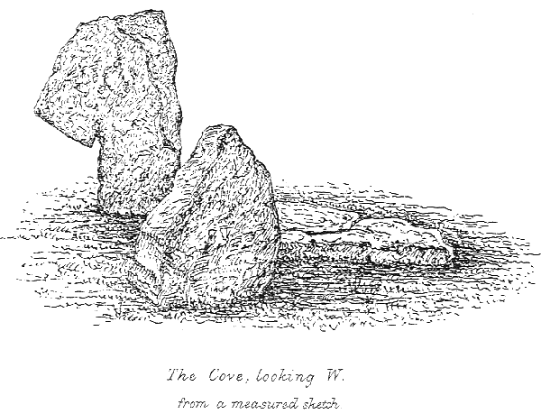
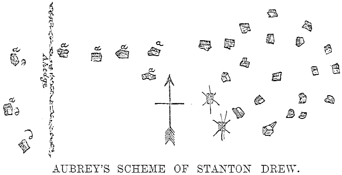
Extract from E. Duke, The Druidical Temples of the County of Wilts (1846)